array:2 [
"RF Cache Key: b0735aac4a8061b99ed36bccbf777f166207eb0ef920ff40272c2634fb2ff8de" => array:1 [
"RF Cached Response" => Realtyna\MlsOnTheFly\Components\CloudPost\SubComponents\RFClient\SDK\RF\RFResponse {#3248
+items: array:1 [
0 => Realtyna\MlsOnTheFly\Components\CloudPost\SubComponents\RFClient\SDK\RF\Entities\RFProperty {#3230
+post_id: ? mixed
+post_author: ? mixed
+"ListingKey": "HMS50156121"
+"ListingId": "2575431"
+"PropertyType": "Land"
+"PropertySubType": "Unimproved Land"
+"StandardStatus": "Pending"
+"ModificationTimestamp": "2026-02-11T17:03:10Z"
+"RFModificationTimestamp": "2026-02-11T17:06:35Z"
+"ListPrice": 15000.0
+"BathroomsTotalInteger": 0
+"BathroomsHalf": 0
+"BedroomsTotal": 0
+"LotSizeArea": 0.83
+"LivingArea": 0
+"BuildingAreaTotal": 0
+"City": "Weir"
+"PostalCode": "66781"
+"UnparsedAddress": "604,608,610,00 W Main Street, Weir, Kansas 66781"
+"Coordinates": array:2 [
0 => -94.778936
1 => 37.309856
]
+"Latitude": 37.309856
+"Longitude": -94.778936
+"YearBuilt": 0
+"InternetAddressDisplayYN": true
+"FeedTypes": "IDX"
+"ListAgentFullName": "Nikki Burton"
+"ListOfficeName": "Burton Real Estate"
+"ListAgentMlsId": "413518193"
+"ListOfficeMlsId": "BURTRE"
+"OriginatingSystemName": "HMLS"
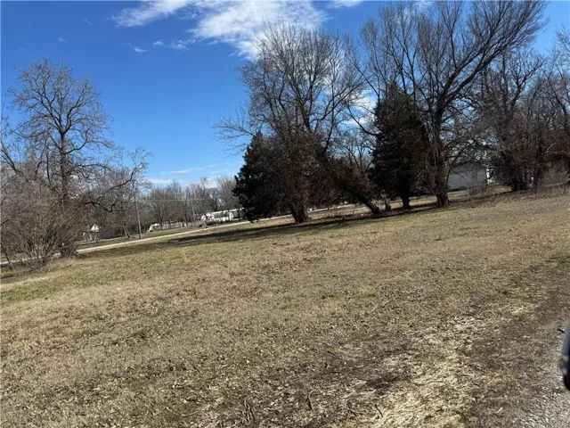
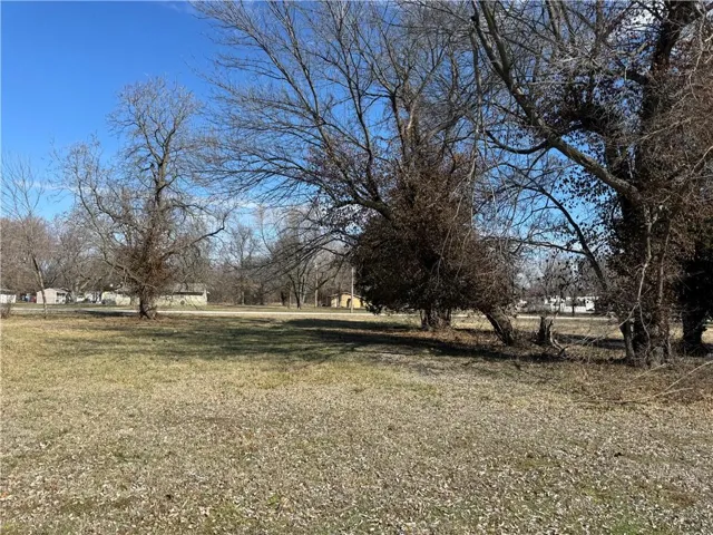
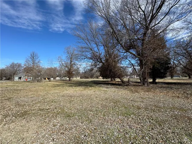
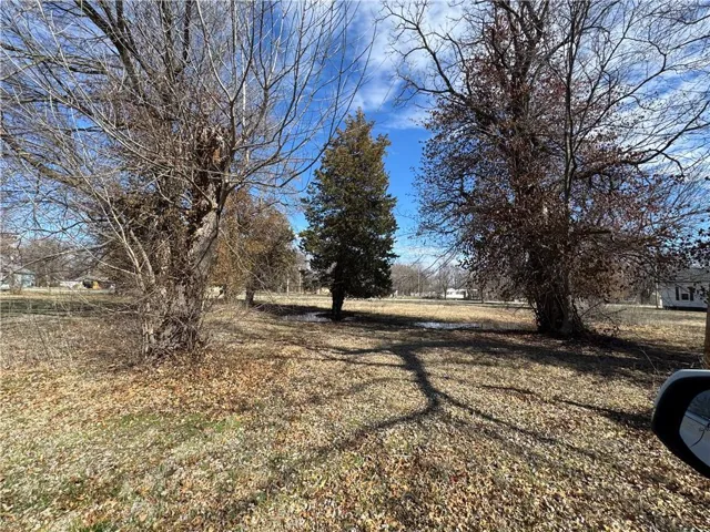
+"PublicRemarks": """
This .83-acre lot offers an excellent location with a variety of possibilities. Whether you’re looking to build your dream home or explore a small business venture, this property is ready for development.\r\n
\r\n
\r\n
.83-acre lot in a highly visible, convenient location\r\n
\r\n
Zoned residential (buyer to verify any potential business use with the city)\r\n
\r\n
On-site water hookup available\r\n
\r\n
Ample space for a home, shop, or investment project\r\n
\r\n
Don’t miss this opportunity to secure a versatile piece of land in a great spot!
"""
+"ActivationDate": "2025-09-12"
+"AssociationFeeFrequency": "None"
+"AttributionContact": "620-704-8888"
+"CountyOrParish": "Cherokee, KS"
+"CreationDate": "2025-09-12T20:12:46.717674+00:00"
+"CurrentUse": array:1 [
0 => "Other"
]
+"Directions": """
Start by heading southwest out of Pittsburg on US-69 S / US-160 W.\r\n
\r\n
Continue on US-69/US-160 for several miles toward Weir.\r\n
\r\n
As you approach Weir, turn right (west) onto Main Street.\r\n
\r\n
Follow Main Street to 604 W Main St, which will be on your left side in Weir.
"""
+"HighSchoolDistrict": "Other"
+"RFTransactionType": "For Sale"
+"InternetEntireListingDisplayYN": true
+"ListAgentDirectPhone": "620-704-8888"
+"ListAgentKey": "34459791"
+"ListOfficeKey": "49925463"
+"ListOfficePhone": "(620) 210-0192"
+"ListingAgreement": "Exclusive Right To Sell"
+"ListingContractDate": "2025-09-12"
+"ListingTerms": array:2 [
0 => "Cash"
1 => "Conventional"
]
+"LotFeatures": array:3 [
0 => "Acreage"
1 => "City Limits"
2 => "City Lot"
]
+"LotSizeSquareFeet": 36154.8
+"MLSAreaMajor": "470 - Cherokee County"
+"MlgCanUse": array:1 [
0 => "IDX"
]
+"MlgCanView": true
+"MlsStatus": "Pending"
+"ParcelNumber": "028-33-0-10-01-002.00-0"
+"PhotosChangeTimestamp": "2025-09-12T20:10:10Z"
+"PhotosCount": 5
+"Possession": array:1 [
0 => "Close Of Escrow"
]
+"PossibleUse": array:2 [
0 => "Other"
1 => "Residential"
]
+"RoadResponsibility": array:1 [
0 => "Other"
]
+"RoadSurfaceType": array:1 [
0 => "None"
]
+"Sewer": array:1 [
0 => "Public Sewer"
]
+"StateOrProvince": "KS"
+"StreetDirPrefix": "W"
+"StreetName": "Main"
+"StreetNumber": "604,608,610,00"
+"StreetSuffix": "Street"
+"SubdivisionName": "None"
+"TaxLegalDescription": "BAKERTON WR, BLOCK 1, LOT 4-6,7,8,9"
+"WaterSource": array:1 [
0 => "City/Public - Verify"
]
+"Zoning": "R"
+"HMS_SaleOptions": "Complete Parcel"
+"HMS_InFloodPlain": "No"
+"HMS_TaxTotalAmount": "140"
+"HMS_BathroomsTotalDecimal": "0.00"
+"HMS_MaintenanceProvidedYN": "0"
+"@odata.id": "https://api.realtyfeed.com/reso/odata/Property('HMS50156121')"
+"provider_name": "HMLS"
+"Media": array:5 [
0 => array:11 [
"Order" => 0
"MediaKey" => "68c47dec978c450a1a2ec343"
"MediaURL" => "https://cdn.realtyfeed.com/cdn/41/HMS50156121/8df9d83bb3742de5f70ca7b0d45a0158.webp"
"MediaSize" => 207627
"MediaType" => "webp"
"Thumbnail" => "https://cdn.realtyfeed.com/cdn/41/HMS50156121/thumbnail-8df9d83bb3742de5f70ca7b0d45a0158.webp"
"ImageWidth" => 1024
"ImageHeight" => 768
"ResourceRecordKey" => "HMS50156121"
"ImageSizeDescription" => "1024x768"
"MediaModificationTimestamp" => "2025-09-12T20:09:16.875Z"
]
1 => array:11 [
"Order" => 1
"MediaKey" => "68c47dec978c450a1a2ec344"
"MediaURL" => "https://cdn.realtyfeed.com/cdn/41/HMS50156121/e634c39835022b82f50abee264faec78.webp"
"MediaSize" => 247422
"MediaType" => "webp"
"Thumbnail" => "https://cdn.realtyfeed.com/cdn/41/HMS50156121/thumbnail-e634c39835022b82f50abee264faec78.webp"
"ImageWidth" => 1024
"ImageHeight" => 768
"ResourceRecordKey" => "HMS50156121"
"ImageSizeDescription" => "1024x768"
"MediaModificationTimestamp" => "2025-09-12T20:09:16.947Z"
]
2 => array:11 [
"Order" => 2
"MediaKey" => "68c47dec978c450a1a2ec345"
"MediaURL" => "https://cdn.realtyfeed.com/cdn/41/HMS50156121/ff92963d16d1a3ab7f8f5e35eb2e95dc.webp"
"MediaSize" => 279782
"MediaType" => "webp"
"Thumbnail" => "https://cdn.realtyfeed.com/cdn/41/HMS50156121/thumbnail-ff92963d16d1a3ab7f8f5e35eb2e95dc.webp"
"ImageWidth" => 1024
"ImageHeight" => 768
"ResourceRecordKey" => "HMS50156121"
"ImageSizeDescription" => "1024x768"
"MediaModificationTimestamp" => "2025-09-12T20:09:16.947Z"
]
3 => array:11 [
"Order" => 3
"MediaKey" => "68c47dec978c450a1a2ec346"
"MediaURL" => "https://cdn.realtyfeed.com/cdn/41/HMS50156121/387490ba427ff94dcef86175e38547e8.webp"
"MediaSize" => 271557
"MediaType" => "webp"
"Thumbnail" => "https://cdn.realtyfeed.com/cdn/41/HMS50156121/thumbnail-387490ba427ff94dcef86175e38547e8.webp"
"ImageWidth" => 1024
"ImageHeight" => 768
"ResourceRecordKey" => "HMS50156121"
"ImageSizeDescription" => "1024x768"
"MediaModificationTimestamp" => "2025-09-12T20:09:16.898Z"
]
4 => array:11 [
"Order" => 4
"MediaKey" => "68c47dec978c450a1a2ec347"
"MediaURL" => "https://cdn.realtyfeed.com/cdn/41/HMS50156121/0d02e573cabf0f8f4e42d9edbb85ec34.webp"
"MediaSize" => 327205
"MediaType" => "webp"
"Thumbnail" => "https://cdn.realtyfeed.com/cdn/41/HMS50156121/thumbnail-0d02e573cabf0f8f4e42d9edbb85ec34.webp"
"ImageWidth" => 1024
"ImageHeight" => 768
"ResourceRecordKey" => "HMS50156121"
"ImageSizeDescription" => "1024x768"
"MediaModificationTimestamp" => "2025-09-12T20:09:16.975Z"
]
]
}
]
+success: true
+page_size: 1
+page_count: 1
+count: 1
+after_key: ""
}
]
"RF Query: /Property?$select=ALL&$orderby=ModificationTimestamp DESC&$top=4&$filter=PropertyType in ('Land', 'Residential') AND PropertySubType eq 'Unimproved Land'/Property?$select=ALL&$orderby=ModificationTimestamp DESC&$top=4&$filter=PropertyType in ('Land', 'Residential') AND PropertySubType eq 'Unimproved Land'&$expand=Media/Property?$select=ALL&$orderby=ModificationTimestamp DESC&$top=4&$filter=PropertyType in ('Land', 'Residential') AND PropertySubType eq 'Unimproved Land'/Property?$select=ALL&$orderby=ModificationTimestamp DESC&$top=4&$filter=PropertyType in ('Land', 'Residential') AND PropertySubType eq 'Unimproved Land'&$expand=Media&$count=true" => array:2 [
"RF Response" => Realtyna\MlsOnTheFly\Components\CloudPost\SubComponents\RFClient\SDK\RF\RFResponse {#3869
+items: array:4 [
0 => Realtyna\MlsOnTheFly\Components\CloudPost\SubComponents\RFClient\SDK\RF\Entities\RFProperty {#3866
+post_id: 244895
+post_author: 1
+"ListingKey": "HMS51284148"
+"ListingId": "2601171"
+"PropertyType": "Land"
+"PropertySubType": "Unimproved Land"
+"StandardStatus": "Coming Soon"
+"ModificationTimestamp": "2026-02-11T18:45:10Z"
+"RFModificationTimestamp": "2026-02-11T18:48:55Z"
+"ListPrice": 92120.0
+"BathroomsTotalInteger": 0
+"BathroomsHalf": 0
+"BedroomsTotal": 0
+"LotSizeArea": 18.8
+"LivingArea": 0
+"BuildingAreaTotal": 0
+"City": "Altoona"
+"PostalCode": "66710"
+"UnparsedAddress": "00000 1800 Road, Altoona, Kansas 66710"
+"Coordinates": array:2 [
0 => -95.669456
1 => 37.631666
]
+"Latitude": 37.631666
+"Longitude": -95.669456
+"YearBuilt": 0
+"InternetAddressDisplayYN": true
+"FeedTypes": "IDX"
+"ListAgentFullName": "Angela Baker"
+"ListOfficeName": "L2 Realty, Inc."
+"ListAgentMlsId": "413007065"
+"ListOfficeMlsId": "L2RI"
+"OriginatingSystemName": "HMLS"
+"ActivationDate": "2026-03-03"
+"AttributionContact": "620-330-3857"
+"CountyOrParish": "Wilson"
+"CreationDate": "2026-02-11T18:48:39.792615+00:00"
+"CurrentUse": array:1 [
0 => "Agricultural"
]
+"Directions": "From Altoona, head north on 75, then head east on 1800 rd, property on south side of road roughly 1 mile"
+"HighSchoolDistrict": "USD 387 - Altoona"
+"RFTransactionType": "For Sale"
+"InternetEntireListingDisplayYN": true
+"ListAgentDirectPhone": "620-330-3857"
+"ListAgentKey": "43352130"
+"ListOfficeKey": "43580951"
+"ListOfficePhone": "620-577-4487"
+"ListingAgreement": "Exclusive Right To Sell"
+"ListingContractDate": "2026-02-10"
+"LotSizeSquareFeet": 818928
+"MLSAreaMajor": "498 - Wilson County, KS"
+"MlgCanUse": array:1 [
0 => "IDX"
]
+"MlgCanView": true
+"MlsStatus": "Coming Soon"
+"ParcelNumber": "103-092-10-0-00-00-001.00-0"
+"PhotosChangeTimestamp": "2026-02-11T18:45:10Z"
+"StateOrProvince": "KS"
+"StreetName": "1800"
+"StreetNumber": "00000"
+"StreetSuffix": "Road"
+"SubdivisionName": "None"
+"TaxLegalDescription": "S10, T28, R16, ACRES 18.8, E2 NE4 NE4 EXC R/W"
+"WaterSource": array:1 [
0 => "Rural - Verify"
]
+"HMS_InFloodPlain": "No"
+"HMS_TaxTotalAmount": "150"
+"HMS_MineralDescription": "All Rights Included"
+"HMS_BathroomsTotalDecimal": "0.00"
+"@odata.id": "https://api.realtyfeed.com/reso/odata/Property('HMS51284148')"
+"provider_name": "HMLS"
+"short_address": "Altoona, Kansas 66710, USA"
+"ID": 244895
}
1 => Realtyna\MlsOnTheFly\Components\CloudPost\SubComponents\RFClient\SDK\RF\Entities\RFProperty {#3874
+post_id: "244887"
+post_author: 1
+"ListingKey": "HMS51279576"
+"ListingId": "2601024"
+"PropertyType": "Land"
+"PropertySubType": "Unimproved Land"
+"StandardStatus": "Active"
+"ModificationTimestamp": "2026-02-11T18:31:10Z"
+"RFModificationTimestamp": "2026-02-11T18:33:20Z"
+"ListPrice": 349900.0
+"BathroomsTotalInteger": 0
+"BathroomsHalf": 0
+"BedroomsTotal": 0
+"LotSizeArea": 3.69
+"LivingArea": 0
+"BuildingAreaTotal": 0
+"City": "Lee's Summit"
+"PostalCode": "64086"
+"UnparsedAddress": "10411 Windsor Drive, Lees Summit, Missouri 64086"
+"Coordinates": array:2 [
0 => -94.30117471
1 => 38.92766982
]
+"Latitude": 38.92766982
+"Longitude": -94.30117471
+"YearBuilt": 0
+"InternetAddressDisplayYN": true
+"FeedTypes": "IDX"
+"ListAgentFullName": "Ask Cathy Team"
+"ListOfficeName": "Keller Williams Platinum Prtnr"
+"ListAgentMlsId": "ASKCATHY"
+"ListOfficeMlsId": "KW02"
+"OriginatingSystemName": "HMLS"
+"PublicRemarks": "Don’t miss your last chance to build your dream home on 3.69 acres in the sought-after Windsor neighborhood. Just minutes from Legacy Park with walking trails, disc golf, indoor basketball courts, a weight room, indoor pool, lakes, and countless amenities. Watch the Lee’s Summit fireworks from your backyard every summer! Convenient access from Colbern Road to Hwy 470 makes this location hard to beat—so HURRY!"
+"ActivationDate": "2026-02-11"
+"AssociationYN": true
+"AttributionContact": "816-268-4033"
+"CoListAgentFullName": "Shelly Rampetsreiter"
+"CoListAgentKey": "1046394"
+"CoListAgentMlsId": "SHELLYR"
+"CoListOfficeKey": "1007957"
+"CoListOfficeMlsId": "KW02"
+"CoListOfficeName": "Keller Williams Platinum Prtnr"
+"CoListOfficePhone": "816-525-7000"
+"CountyOrParish": "Jackson"
+"CreationDate": "2026-02-11T15:25:31.063197+00:00"
+"CurrentUse": array:1 [
0 => "Single Family"
]
+"DevelopmentStatus": array:1 [
0 => "Finished Lot(s)"
]
+"Directions": "Colbern Road to Windsor Dr. South on Windsor Drive. Property will be on your left."
+"DocumentsAvailable": array:1 [
0 => "Aerial Photos"
]
+"ElementarySchool": "Mason"
+"HighSchool": "Lee's Summit North"
+"HighSchoolDistrict": "Lee's Summit"
+"RFTransactionType": "For Sale"
+"InternetEntireListingDisplayYN": true
+"ListAgentDirectPhone": "816-268-4033"
+"ListAgentKey": "1056608"
+"ListOfficeKey": "1007957"
+"ListOfficePhone": "816-525-7000"
+"ListingAgreement": "Exclusive Right To Sell"
+"ListingContractDate": "2026-02-11"
+"ListingTerms": "Cash,Conventional"
+"LotFeatures": array:3 [
0 => "Acreage"
1 => "Estate Lot"
2 => "Level"
]
+"LotSizeSquareFeet": 160736.4
+"MLSAreaMajor": "204 - Lee's Summit Area"
+"MiddleOrJuniorSchool": "Bernard Campbell"
+"MlgCanUse": array:1 [
0 => "IDX"
]
+"MlgCanView": true
+"MlsStatus": "Active"
+"ParcelNumber": "53-800-04-24-00-0-00-000"
+"PhotosChangeTimestamp": "2026-02-11T15:21:10Z"
+"PhotosCount": 9
+"Possession": array:1 [
0 => "Negotiable"
]
+"PossibleUse": array:1 [
0 => "Residential"
]
+"RoadResponsibility": array:1 [
0 => "Other"
]
+"RoadSurfaceType": array:1 [
0 => "Asphalt"
]
+"Sewer": "None"
+"SpecialListingConditions": array:1 [
0 => "Auction"
]
+"StateOrProvince": "MO"
+"StreetName": "Windsor"
+"StreetNumber": "10411"
+"StreetSuffix": "Drive"
+"SubdivisionName": "Windsor"
+"TaxLegalDescription": "Windsor 9th Plat - Lot 83"
+"Utilities": "Natural Gas Available"
+"Vegetation": array:1 [
0 => "Cleared"
]
+"WaterSource": array:1 [
0 => "Public"
]
+"Zoning": "Res"
+"HMS_SaleOptions": "Complete Parcel"
+"HMS_InFloodPlain": "No"
+"HMS_Restrictions": "Recorded Plat,Subdivision"
+"HMS_TaxTotalAmount": "2814"
+"HMS_BathroomsTotalDecimal": "0.00"
+"HMS_MaintenanceProvidedYN": "0"
+"@odata.id": "https://api.realtyfeed.com/reso/odata/Property('HMS51279576')"
+"provider_name": "HMLS"
+"Media": array:9 [
0 => array:11 [
"Order" => 0
"MediaKey" => "698c9e47d720b00ee6925f2f"
"MediaURL" => "https://cdn.realtyfeed.com/cdn/41/HMS51279576/41dd4b21c6b6a0dbbb424da93ff9f9c4.webp"
"MediaSize" => 150117
"MediaType" => "webp"
"Thumbnail" => "https://cdn.realtyfeed.com/cdn/41/HMS51279576/thumbnail-41dd4b21c6b6a0dbbb424da93ff9f9c4.webp"
"ImageWidth" => 1024
"ImageHeight" => 682
"ResourceRecordKey" => "HMS51279576"
"ImageSizeDescription" => "1024x682"
"MediaModificationTimestamp" => "2026-02-11T15:20:39.911Z"
]
1 => array:11 [
"Order" => 1
"MediaKey" => "698c9e47d720b00ee6925f30"
"MediaURL" => "https://cdn.realtyfeed.com/cdn/41/HMS51279576/4b819c2b451f892ca29dccc5344bbe44.webp"
"MediaSize" => 152006
"MediaType" => "webp"
"Thumbnail" => "https://cdn.realtyfeed.com/cdn/41/HMS51279576/thumbnail-4b819c2b451f892ca29dccc5344bbe44.webp"
"ImageWidth" => 1024
"ImageHeight" => 682
"ResourceRecordKey" => "HMS51279576"
"ImageSizeDescription" => "1024x682"
"MediaModificationTimestamp" => "2026-02-11T15:20:39.903Z"
]
2 => array:11 [
"Order" => 2
"MediaKey" => "698c9e47d720b00ee6925f31"
"MediaURL" => "https://cdn.realtyfeed.com/cdn/41/HMS51279576/bc75799a67b8d29bff6495c3df9be6d5.webp"
"MediaSize" => 120708
"MediaType" => "webp"
"Thumbnail" => "https://cdn.realtyfeed.com/cdn/41/HMS51279576/thumbnail-bc75799a67b8d29bff6495c3df9be6d5.webp"
"ImageWidth" => 1024
"ImageHeight" => 682
"ResourceRecordKey" => "HMS51279576"
"ImageSizeDescription" => "1024x682"
"MediaModificationTimestamp" => "2026-02-11T15:20:39.918Z"
]
3 => array:11 [
"Order" => 3
"MediaKey" => "698c9e47d720b00ee6925f32"
"MediaURL" => "https://cdn.realtyfeed.com/cdn/41/HMS51279576/e19cb69a0477bc7e953251d9225be0a4.webp"
"MediaSize" => 121640
"MediaType" => "webp"
"Thumbnail" => "https://cdn.realtyfeed.com/cdn/41/HMS51279576/thumbnail-e19cb69a0477bc7e953251d9225be0a4.webp"
"ImageWidth" => 1024
"ImageHeight" => 682
"ResourceRecordKey" => "HMS51279576"
"ImageSizeDescription" => "1024x682"
"MediaModificationTimestamp" => "2026-02-11T15:20:39.901Z"
]
4 => array:11 [
"Order" => 4
"MediaKey" => "698c9e47d720b00ee6925f33"
"MediaURL" => "https://cdn.realtyfeed.com/cdn/41/HMS51279576/3f789c7fd8f80bbffa2e410597480224.webp"
"MediaSize" => 135067
"MediaType" => "webp"
"Thumbnail" => "https://cdn.realtyfeed.com/cdn/41/HMS51279576/thumbnail-3f789c7fd8f80bbffa2e410597480224.webp"
"ImageWidth" => 1024
"ImageHeight" => 682
"ResourceRecordKey" => "HMS51279576"
"ImageSizeDescription" => "1024x682"
"MediaModificationTimestamp" => "2026-02-11T15:20:39.912Z"
]
5 => array:11 [
"Order" => 5
"MediaKey" => "698c9e47d720b00ee6925f34"
"MediaURL" => "https://cdn.realtyfeed.com/cdn/41/HMS51279576/e4ec2dd11bda7ad39dabedd06fef6258.webp"
"MediaSize" => 133787
"MediaType" => "webp"
"Thumbnail" => "https://cdn.realtyfeed.com/cdn/41/HMS51279576/thumbnail-e4ec2dd11bda7ad39dabedd06fef6258.webp"
"ImageWidth" => 1024
"ImageHeight" => 682
"ResourceRecordKey" => "HMS51279576"
"ImageSizeDescription" => "1024x682"
"MediaModificationTimestamp" => "2026-02-11T15:20:39.899Z"
]
6 => array:11 [
"Order" => 6
"MediaKey" => "698c9e47d720b00ee6925f35"
"MediaURL" => "https://cdn.realtyfeed.com/cdn/41/HMS51279576/ca100872b599d8b2bceb14234ed07163.webp"
"MediaSize" => 141059
"MediaType" => "webp"
"Thumbnail" => "https://cdn.realtyfeed.com/cdn/41/HMS51279576/thumbnail-ca100872b599d8b2bceb14234ed07163.webp"
"ImageWidth" => 1024
"ImageHeight" => 682
"ResourceRecordKey" => "HMS51279576"
"ImageSizeDescription" => "1024x682"
"MediaModificationTimestamp" => "2026-02-11T15:20:39.906Z"
]
7 => array:11 [
"Order" => 7
"MediaKey" => "698c9e47d720b00ee6925f36"
"MediaURL" => "https://cdn.realtyfeed.com/cdn/41/HMS51279576/8ee75e6160b592b8d9f33736fa2b0ab2.webp"
"MediaSize" => 132410
"MediaType" => "webp"
"Thumbnail" => "https://cdn.realtyfeed.com/cdn/41/HMS51279576/thumbnail-8ee75e6160b592b8d9f33736fa2b0ab2.webp"
"ImageWidth" => 1024
"ImageHeight" => 682
"ResourceRecordKey" => "HMS51279576"
"ImageSizeDescription" => "1024x682"
"MediaModificationTimestamp" => "2026-02-11T15:20:39.920Z"
]
8 => array:11 [
"Order" => 8
"MediaKey" => "698c9e47d720b00ee6925f37"
"MediaURL" => "https://cdn.realtyfeed.com/cdn/41/HMS51279576/20abc1b70005f795567bf815166786a4.webp"
"MediaSize" => 154762
"MediaType" => "webp"
"Thumbnail" => "https://cdn.realtyfeed.com/cdn/41/HMS51279576/thumbnail-20abc1b70005f795567bf815166786a4.webp"
"ImageWidth" => 1024
"ImageHeight" => 682
"ResourceRecordKey" => "HMS51279576"
"ImageSizeDescription" => "1024x682"
"MediaModificationTimestamp" => "2026-02-11T15:20:39.914Z"
]
]
+"ID": "244887"
}
2 => Realtyna\MlsOnTheFly\Components\CloudPost\SubComponents\RFClient\SDK\RF\Entities\RFProperty {#3864
+post_id: "236394"
+post_author: 1
+"ListingKey": "HMS51057245"
+"ListingId": "2595570"
+"PropertyType": "Land"
+"PropertySubType": "Unimproved Land"
+"StandardStatus": "Active"
+"ModificationTimestamp": "2026-02-11T17:41:10Z"
+"RFModificationTimestamp": "2026-02-11T17:42:04Z"
+"ListPrice": 370000.0
+"BathroomsTotalInteger": 0
+"BathroomsHalf": 0
+"BedroomsTotal": 0
+"LotSizeArea": 2.0
+"LivingArea": 0
+"BuildingAreaTotal": 0
+"City": "Louisburg"
+"PostalCode": "66053"
+"UnparsedAddress": "9960 W W K68 Highway, Louisburg, Kansas 66053"
+"Coordinates": array:2 [
0 => -94.70091636
1 => 38.62192541
]
+"Latitude": 38.62192541
+"Longitude": -94.70091636
+"YearBuilt": 0
+"InternetAddressDisplayYN": true
+"FeedTypes": "IDX"
+"ListAgentFullName": "Robert Zoller"
+"ListOfficeName": "KW Diamond Partners"
+"ListAgentMlsId": "ZOLLBOB"
+"ListOfficeMlsId": "KW05"
+"OriginatingSystemName": "HMLS"
+"PublicRemarks": "2.0 ac M/L in Louisburg City Limits and close to the Louisburg Exit off of 69 Hwy. The property sites along a newly created frontage road that is wide and paved."
+"ActivationDate": "2026-01-09"
+"AssociationFeeFrequency": "None"
+"AttributionContact": "913-285-3608"
+"CoListAgentFullName": "Alice Medina"
+"CoListAgentKey": "1044430"
+"CoListAgentMlsId": "MEDINA"
+"CoListOfficeKey": "1007960"
+"CoListOfficeMlsId": "KW05"
+"CoListOfficeName": "KW Diamond Partners"
+"CoListOfficePhone": "913-322-7500"
+"CountyOrParish": "Miami"
+"CreationDate": "2026-01-10T11:43:39.691710+00:00"
+"CurrentUse": array:3 [
0 => "Commercial"
1 => "Investment"
2 => "Other"
]
+"DevelopmentStatus": array:2 [
0 => "Other"
1 => "Raw Land"
]
+"Directions": "South on 69Hwy to the Louisburg exit / 68 Hwy exit, west on 68 HWY take first turn on right which is Fairlane Dr. property is a N/W corner of Fairlane Dr & W 278th Terr."
+"DocumentsAvailable": array:1 [
0 => "Other"
]
+"Fencing": array:1 [
0 => "Partial"
]
+"HighSchoolDistrict": "Louisburg"
+"RFTransactionType": "For Sale"
+"InternetAutomatedValuationDisplayYN": true
+"InternetEntireListingDisplayYN": true
+"ListAgentDirectPhone": "913-285-3608"
+"ListAgentKey": "1048449"
+"ListOfficeKey": "1007960"
+"ListOfficePhone": "913-322-7500"
+"ListingAgreement": "Exclusive Right To Sell"
+"ListingContractDate": "2026-01-09"
+"ListingTerms": "Cash,Conventional"
+"LotFeatures": array:2 [
0 => "Acreage"
1 => "Cul-De-Sac"
]
+"LotSizeSquareFeet": 87120
+"MLSAreaMajor": "380 - Miami County, KS"
+"MlgCanUse": array:1 [
0 => "IDX"
]
+"MlgCanView": true
+"MlsStatus": "Active"
+"OtherEquipment": array:1 [
0 => "None"
]
+"OtherStructures": array:1 [
0 => "None"
]
+"ParcelNumber": "097-25-0-00-00-017.00-0"
+"PhotosChangeTimestamp": "2026-01-10T11:42:10Z"
+"PhotosCount": 1
+"Possession": array:1 [
0 => "Close Of Escrow"
]
+"PossibleUse": array:1 [
0 => "Other"
]
+"RoadFrontageType": array:1 [
0 => "Highway"
]
+"RoadResponsibility": array:1 [
0 => "Public Maintenance"
]
+"RoadSurfaceType": array:2 [
0 => "Asphalt"
1 => "Gravel"
]
+"Sewer": "None"
+"StateOrProvince": "KS"
+"StreetDirPrefix": "W"
+"StreetName": "W K68"
+"StreetNumber": "9960"
+"StreetSuffix": "Highway"
+"SubdivisionName": "Louisburg"
+"TaxLegalDescription": "Tract B containing 2.0 acres M/L located in S25. T16. R24, Tract B"
+"Topography": "Level"
+"Utilities": "Electricity - Verify"
+"Vegetation": array:2 [
0 => "Cleared"
1 => "Partially Wooded"
]
+"WaterSource": array:1 [
0 => "Rural - Verify"
]
+"Zoning": "farm"
+"HMS_Crops": "None,See Remarks"
+"HMS_Telecom": "Fiber - Available"
+"HMS_SoilType": "Unknown-Verify"
+"HMS_SaleOptions": "Complete Parcel"
+"HMS_InFloodPlain": "No"
+"HMS_Restrictions": "Easement,Subject To Zoning"
+"HMS_TaxTotalAmount": "300"
+"HMS_AgricultureType": "Pasture"
+"HMS_InsideCityLimits": "No"
+"HMS_MineralDescription": "All Rights Included"
+"HMS_ImprovementFeatures": "No Improvements"
+"HMS_BathroomsTotalDecimal": "0.00"
+"HMS_MaintenanceProvidedYN": "0"
+"@odata.id": "https://api.realtyfeed.com/reso/odata/Property('HMS51057245')"
+"provider_name": "HMLS"
+"Media": array:1 [
0 => array:11 [
"Order" => 0
"MediaKey" => "69623ad9cd6cb01ba9c23691"
"MediaURL" => "https://cdn.realtyfeed.com/cdn/41/HMS51057245/39dadf6d4c9802402690046fa28646cd.webp"
"MediaSize" => 102758
"MediaType" => "webp"
"Thumbnail" => "https://cdn.realtyfeed.com/cdn/41/HMS51057245/thumbnail-39dadf6d4c9802402690046fa28646cd.webp"
"ImageWidth" => 768
"ImageHeight" => 768
"ResourceRecordKey" => "HMS51057245"
"ImageSizeDescription" => "768x768"
"MediaModificationTimestamp" => "2026-01-10T11:41:13.825Z"
]
]
+"ID": "236394"
}
3 => Realtyna\MlsOnTheFly\Components\CloudPost\SubComponents\RFClient\SDK\RF\Entities\RFProperty {#3887
+post_id: "158119"
+post_author: 1
+"ListingKey": "HMS1649320"
+"ListingId": "1922754"
+"PropertyType": "Land"
+"PropertySubType": "Unimproved Land"
+"StandardStatus": "Active"
+"ModificationTimestamp": "2026-02-11T17:39:10Z"
+"RFModificationTimestamp": "2026-02-11T17:42:07Z"
+"ListPrice": 350000.0
+"BathroomsTotalInteger": 0
+"BathroomsHalf": 0
+"BedroomsTotal": 0
+"LotSizeArea": 17980.0
+"LivingArea": 0
+"BuildingAreaTotal": 0
+"City": "Lansing"
+"PostalCode": "66043"
+"UnparsedAddress": " , Lansing, Leavenworth County, Kansas 66043, USA "
+"Coordinates": array:2 [
0 => -94.900246
1 => 39.248739
]
+"Latitude": 39.248739
+"Longitude": -94.900246
+"YearBuilt": 0
+"InternetAddressDisplayYN": true
+"FeedTypes": "IDX"
+"ListAgentFullName": "Mike Reilly"
+"ListOfficeName": "Reilly Real Estate LLC"
+"ListAgentMlsId": "MIKERE"
+"ListOfficeMlsId": "RILY"
+"OriginatingSystemName": "HMLS"
+"PublicRemarks": "Great Lot on Main Street for development. Sold separately or together with 202 Main Street"
+"ActivationDate": "2015-02-17"
+"AttributionContact": "913-683-0233"
+"CountyOrParish": "Leavenworth"
+"CreationDate": "2023-08-17T13:16:16.296234+00:00"
+"CurrentUse": array:1 [
0 => "Other"
]
+"Directions": "Main Street just North of West Mary Street"
+"HighSchoolDistrict": "Lansing"
+"RFTransactionType": "For Sale"
+"InternetEntireListingDisplayYN": true
+"ListAgentDirectPhone": "913-683-0233"
+"ListAgentKey": "1044555"
+"ListOfficeKey": "1008344"
+"ListOfficePhone": "913-682-2567"
+"ListingAgreement": "Exclusive Right To Sell"
+"ListingContractDate": "2015-02-14"
+"ListingTerms": "Cash,Conventional"
+"LotSizeSquareFeet": 17980
+"MLSAreaMajor": "427 - N=Lv Co Ln;S=Co Rd 8;E=Mo Rvr;W=Lv Co Ln"
+"MlgCanUse": array:1 [
0 => "IDX"
]
+"MlgCanView": true
+"MlsStatus": "Active"
+"ParcelNumber": "13557"
+"PhotosChangeTimestamp": "2021-04-22T22:43:07Z"
+"PhotosCount": 1
+"Possession": array:1 [
0 => "Close Of Escrow"
]
+"PossibleUse": array:1 [
0 => "Commercial"
]
+"RoadResponsibility": array:1 [
0 => "Public Maintenance"
]
+"RoadSurfaceType": array:1 [
0 => "Asphalt"
]
+"Sewer": "Public Sewer"
+"StateOrProvince": "KS"
+"StreetDirPrefix": "S"
+"StreetName": "Main"
+"StreetNumber": "124"
+"StreetSuffix": "Street"
+"SubdivisionName": "Other"
+"TaxLegalDescription": "CAll Office"
+"WaterSource": array:1 [
0 => "Public"
]
+"Zoning": "Com"
+"HMS_SaleOptions": "Will Sell 1 Lot"
+"HMS_InFloodPlain": "No"
+"HMS_TaxTotalAmount": "588"
+"HMS_MaintenanceProvidedYN": "0"
+"@odata.id": "https://api.realtyfeed.com/reso/odata/Property('HMS1649320')"
+"provider_name": "HMLS"
+"Media": array:1 [
0 => array:9 [
"Order" => 0
"MediaKey" => "5fdec4b5eea09d75bf05ec36"
"MediaURL" => "https://cdn.realtyfeed.com/cdn/41/HMS1649320/6f789bbd0b1d3ba1db4a9a7d7ab9e5cb.jpeg"
"MediaSize" => 119568
"Thumbnail" => "https://cdn.realtyfeed.com/cdn/41/HMS1649320/thumbnail-6f789bbd0b1d3ba1db4a9a7d7ab9e5cb.jpeg"
"ImageWidth" => 1024
"ImageHeight" => 681
"ImageSizeDescription" => "1024x681"
"MediaModificationTimestamp" => "2020-10-23T20:02:09.997Z"
]
]
+"ID": "158119"
}
]
+success: true
+page_size: 4
+page_count: 1440
+count: 5757
+after_key: ""
}
"RF Response Time" => "0.11 seconds"
]
]